
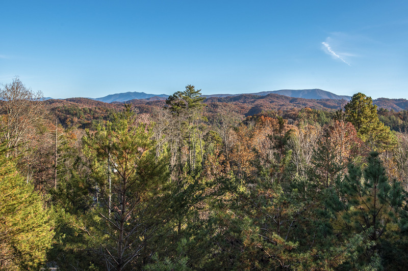
Tennessee, a southeastern U.S. state, is known for its beautiful landscapes, with mountains covering about one-third of the area. These mountains belong to three main ranges: the Appalachian Mountains, the Cumberland Plateau, and the Unaka Mountains. Each range has its own unique attractions for both locals and visitors.
In this article, we're going to explore Tennessee's highest peaks, uncovering the Top 6 Highest Mountains. Get ready for not just stunning visuals but also practical tips tailored for climbing enthusiasts. Start your adventure today!
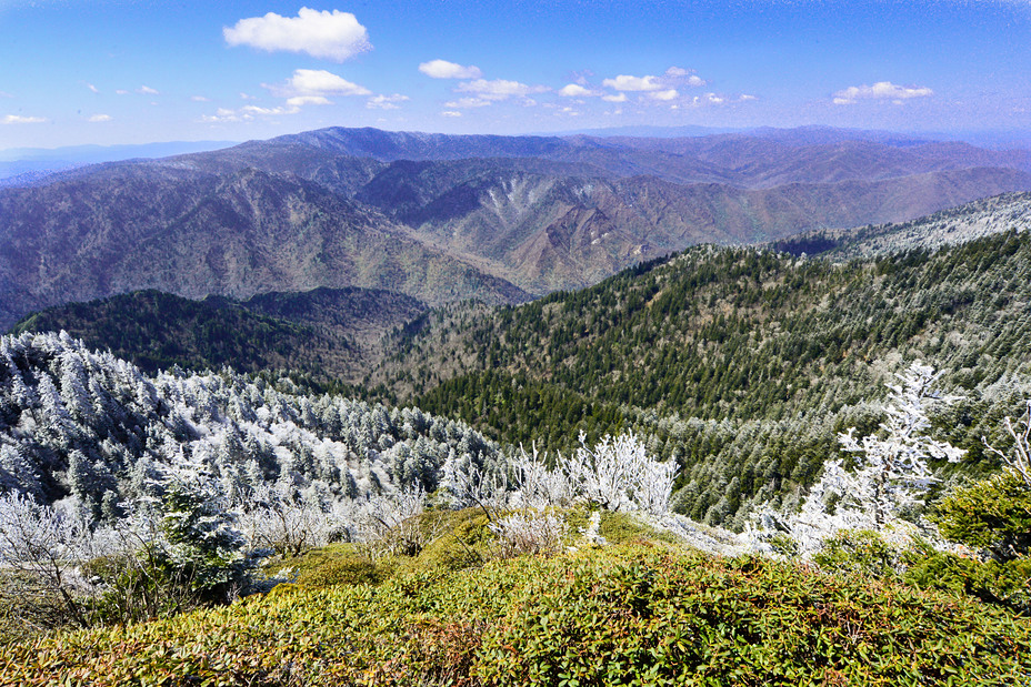
🗻 Clingmans Dome | 6,643 feet
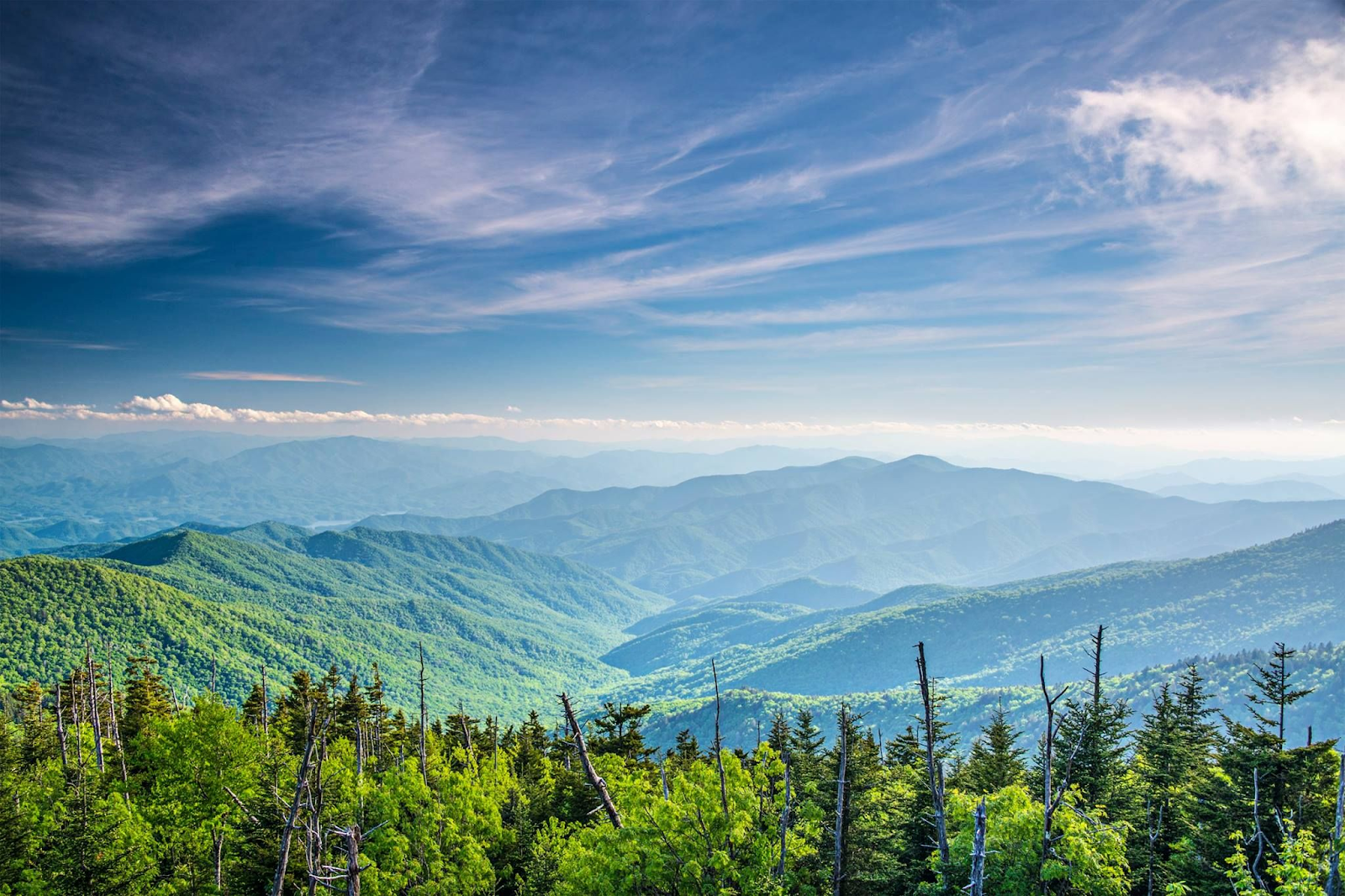
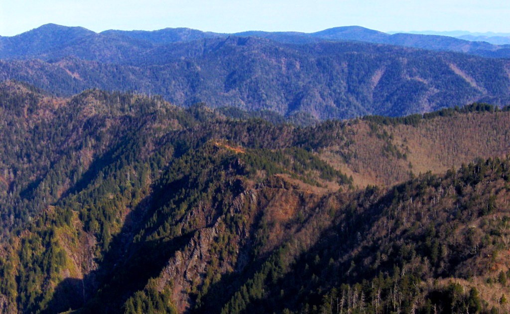
Clingmans Dome is a mountain that lies on the border of Tennessee and North Carolina in the Great Smoky Mountains National Park. It is the highest point in Tennessee, with an elevation of 6,643 feet, and the third highest point in eastern North America, after Mount Mitchell and Mount Craig in North Carolina.
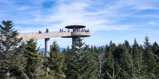
The mountain is named after Thomas Lanier Clingman, a U.S. senator and explorer who measured its height in 1858. Clingmans Dome has a distinctive concrete observation tower on its summit, which offers panoramic views of the surrounding mountains and valleys. The tower was built in 1959 and is listed on the National Register of Historic Places.
Clingmans Dome is accessible by a paved road that leads to a parking area, from which a steep half-mile trail leads to the top. The mountain is covered by a spruce-fir forest that is home to many rare plants and animals, but also threatened by air pollution and invasive insects.
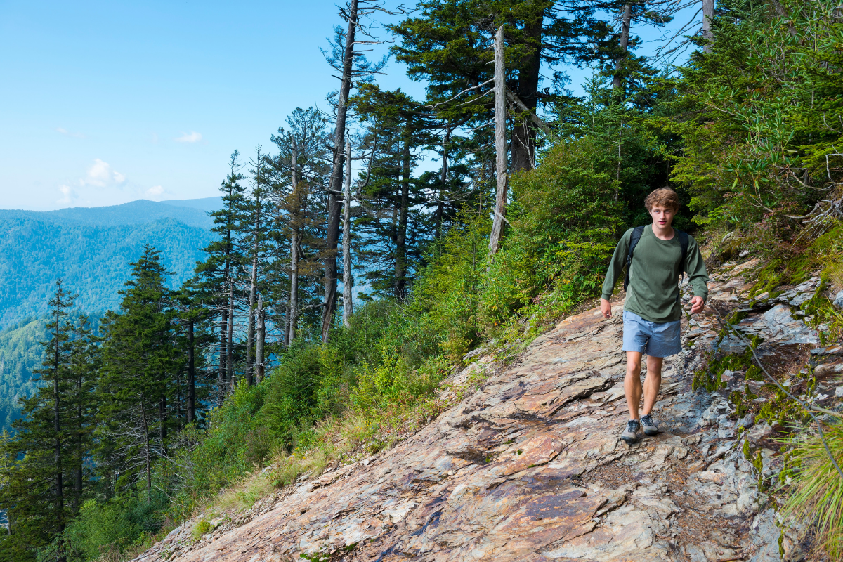
CHALLENGES AND ADVICE FOR CLIMBERS
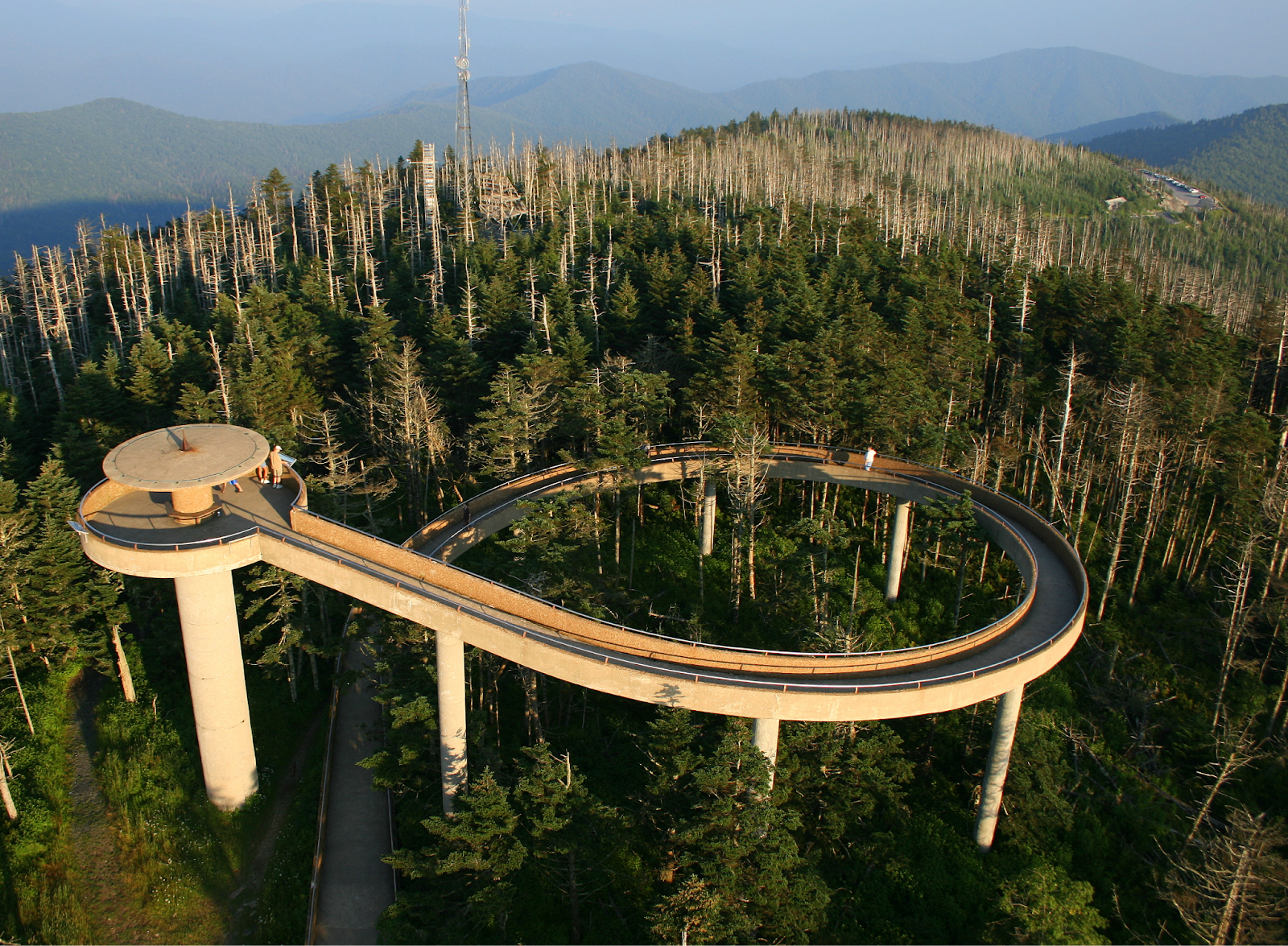
The observation tower. (Source: communitytectonics.com)
- High Elevation: Clingmans Dome is the tallest spot in Tennessee and the third tallest in the Appalachian Mountains, standing way up at 2025 meters above sea level. Going up there means dealing with high elevation, and that can make you feel a bit off.
Take it slow, drink water, and pay attention to how your body feels. Move at a steady pace to avoid any problems that might come with the thin air.
- Cold and Windy Weather: When you're at the tippy-top of Clingmans Dome, it gets cold. Like, 10°C colder than down in the lowlands. Plus, the wind can kick up, going faster than 160 km/h. Bundle up with layers, wear something to block the wind, and bring gloves and a hat.
Being prepared for the chilly and windy conditions will make your climb much more comfortable.
- Air Pollution: The air around Clingmans Dome isn't always as clean as we'd like. There's haze and smog from nearby cities and factories, making it harder to see and not great for breathing.
If you're sensitive to that stuff, maybe wear a mask. Pick days with better weather forecasts to enjoy the views without dealing too much with the not-so-great air.
- Accessibility: Getting to Clingmans Dome can be a challenge too. The road up there is closed from December 1 to March 31, so don't plan a trip during those months. And if you use a wheelchair, keep in mind that the tower at the top isn't accessible.
Check the open dates and maybe explore other trails if the road is closed to still enjoy the area.
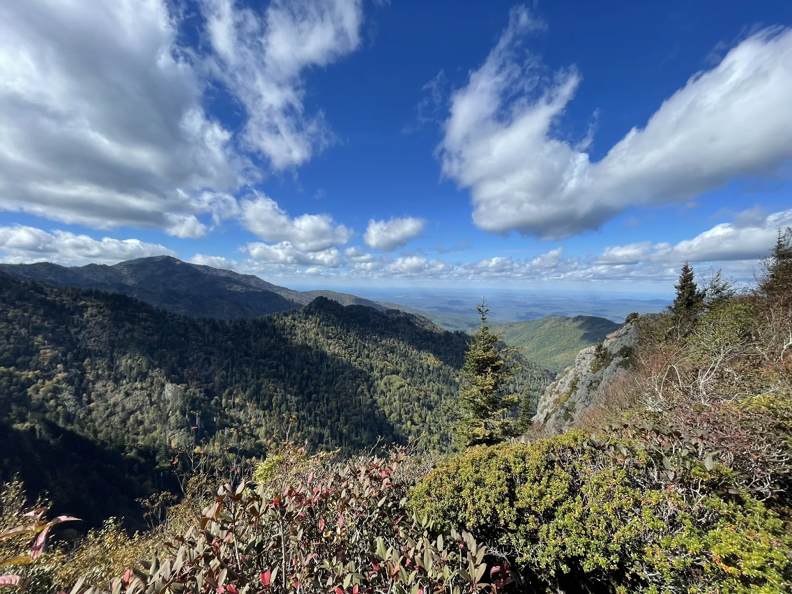
🗻 Mount Guyot | 6,621 feet
Mount Guyot is the second-highest peak in Tennessee, with an elevation of 6,621 feet (2,018 m) above sea level. It is located in the eastern Great Smoky Mountains, on the border between Sevier County, Tennessee, and Haywood County, North Carolina. It is the second-highest peak in the Great Smoky Mountains National Park and the fourth-highest summit in the eastern United States.
Mount Guyot is a remote and wild mountain, with no maintained trail to its summit. The mountain is covered by a dense forest of Fraser firs and balsam firs, some of which are old-growth. The summit itself is a tangled mass of fallen limbs and thorny vines, with no clear views. Mount Guyot is named after Arnold Henry Guyot, a Swiss-American geographer who measured many of the peaks in the Smoky Mountains in the 1850s.
CHALLENGES AND ADVICE FOR CLIMBERS

- High Altitude and Thin Air: Climbing up high, like at Mount Guyot, might make you feel a bit sick, tired, or thirsty because of the thin air.
If you're not used to it, take it slow, drink a bunch of water, and pay attention to how your body feels. If things start feeling not-so-great or you get extra tired, it's okay to take a break or come down a bit to get used to the height more gradually.
- Unpredictable Weather: The weather up there can switch up fast, bringing on strong winds, unexpected snow, and even lightning.
Before you head out, check the weather forecast, and be ready for changes. Wear layers, bring waterproof stuff, and keep an eye on the sky to stay safe during your climb.
- Steep and Rocky Terrain: The ground at Mount Guyot is a bit rough, with bumps, steep parts, and rocks, maybe even some snow and ice.
If you're climbing, gear up with ropes, crampons, and ice axes to move around safely. Make sure your gear is good to go before you start and take your time stepping on the tricky ground.
- Long and Remote Journey: Reaching the top takes some time, and Mount Guyot is kind of out there by itself.
Plan for a few days and be ready to camp in the wild. Bring enough food, water, and gear for the whole trip. Check the route, know where you can camp, and be super ready for how far and remote it is.
🗻 Mount Le Conte | 6,593 feet
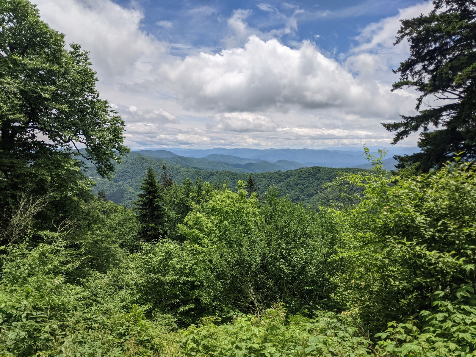
Mount Le Conte is one of the most prominent mountains in the Great Smoky Mountains National Park, located in Sevier County, Tennessee. It has an elevation of 6,593 feet, making it the third-highest peak in the park and the highest peak entirely within Tennessee. The mountain has four subpeaks above 6,000 feet: West Point, High Top, Cliff Tops, and Myrtle Point. It also has a lodge that provides overnight lodging for visitors, which is the highest inn in the Eastern United States.
Mount Le Conte offers spectacular views of the surrounding landscape from its summit, especially from Cliff Tops and Myrtle Point. The mountain can be accessed by several hiking trails that vary in length and difficulty. Mount Le Conte is a popular destination for hikers, nature lovers, and photographers who want to experience the beauty and diversity of the Smoky Mountains.
CHALLENGES AND ADVICE FOR CLIMBERS
- High Elevation: Going up Mount Le Conte means dealing with high elevation. The air gets thinner, and that can make you feel dehydrated and more tired.
If you're not used to it, take it slow, drink lots of water, and pay attention to how you're feeling. If you start getting too tired or not so great, it's okay to take breaks or come down a bit to get used to the height more slowly.
- Steep Terrain: The trails to Mount Le Conte are pretty tough, all steep and rocky. You'll need good balance, strength, and endurance.
Wear sturdy shoes with good grip, bring enough water and snacks, and pace yourself. Take your time on those rocky paths, and make sure each step is solid. Being ready for the physical work will help you handle the climb better.
- Weather Conditions: Mount Le Conte is known for its tricky weather that can change fast. You might run into rain, snow, wind, fog, and cold temperatures.
Before you start your hike, check what the weather's supposed to be like. Wear layers so you can adjust to the changing temps, bring something waterproof, and have emergency stuff just in case. If the weather gets too dicey, it's smart to turn back and keep safe rather than pushing to the top.
🗻 Mount Chapman | 6,340 feet

Mount Chapman is the fourth-highest peak in Tennessee, with an elevation of 6,340 feet (1,930 meters). It is located in the Great Smoky Mountains National Park, near the border with North Carolina. Mount Chapman is named after John Chapman, a pioneer and explorer who settled in the area in the early 1800s.
As part of the Appalachian Mountains, a range that stretches from Georgia to Maine, the mountain is covered with forests of spruce, fir, and hardwoods, and is home to a variety of wildlife, such as black bears, deer, and bobcats.
A favorite spot for hikers, Mount Chapman's summit can be reached via the Appalachian Trail or other connecting trails. The views from the top are spectacular, especially on clear days when the surrounding peaks and valleys come into view. Mount Chapman stands as a natural wonder, showcasing the beauty and diversity of Tennessee's landscape.
CHALLENGES AND ADVICE FOR CLIMBERS
- High Altitude and Low Oxygen Levels: Climbing Mount Chapman means dealing with high altitude, which can lead to lower oxygen levels.
Take it slow, stay hydrated, and be aware of symptoms like fatigue. If you feel unwell, descend to acclimate more gradually.
- Extreme Weather Conditions and Avalanches: The weather on Mount Chapman can be unpredictable.
Check forecasts before you start, and be ready for sudden changes. Dress in layers to handle temperature swings. Be cautious of avalanche risks, especially in winter, and avoid risky areas during bad weather.
- Technical Difficulty and Steep Terrain: Mount Chapman has tough terrain with steep rocks. Gear up with good boots, ropes, and climbing tools.
Build your strength before attempting the climb and take your time on tricky sections, making sure each step is secure.
- Lack of Rescue Services and Communication: Keep in mind that Mount Chapman is in a remote area. Rescue services may not be immediate.
Share your plans with someone reliable, and carry a communication device like a satellite phone for emergencies.
- Environmental Impact and Ethical Issues: Respect the environment to minimize your impact. Stick to marked trails to protect ecosystems, follow Leave No Trace principles, and pack out all waste.
Avoid disturbing wildlife and be considerate of fellow hikers. Practice ethical hiking to preserve Mount Chapman's beauty.
🗻 Old Black | 6,370 feet

The Old Black is the fifth-highest peak in Tennessee, with an elevation of 6,370 feet (1,940 meters). It is located in the Great Smoky Mountains National Park, near the border with North Carolina. The mountain is named for its dark appearance, which is caused by the dense spruce-fir forest that covers its slopes. The Old Black is part of the Appalachian Trail, a 2,200-mile (3,500-km) hiking trail that stretches from Georgia to Maine.
The summit of the Old Black offers spectacular views of the surrounding peaks and valleys, as well as a variety of wildlife and plants. The Old Black is a popular destination for hikers, backpackers, and nature lovers who want to experience the beauty and challenge of the Smoky Mountains.
CHALLENGES AND ADVICE FOR CLIMBERS
- High Altitude and Tough Terrain: Old Black is no easy feat. Climbers deal with steep slopes, unpredictable weather, and the challenge of less oxygen up high.
Take it slow, stay hydrated, and make sure you're physically ready for the climb.
- Physical and Mental Toughness: Climbing Old Black isn't just about muscles; you need mental strength too.
Build up your stamina with cardio and strength exercises. Get mentally ready for the challenges, stay focused, and watch out for signs of altitude sickness or exhaustion.
- Skills and Gear: Tackling Old Black means having the right skills and gear.
Grab solid hiking boots, sturdy ropes, and climbing tools. Check your gear before hitting the trail. Learn some basic climbing techniques, especially for those steep slopes.
- Environmental Respect: While conquering Old Black, be mindful of your impact.
Stick to the trails to keep from disturbing the local ecosystem. Follow Leave No Trace principles—pack out everything you bring in. Respect the natural and cultural heritage of the area by avoiding harm to the plants and animals. Stay on the marked paths to preserve Old Black's beauty for future adventurers.
🗻 Mount Kephart | 6,217 feet
Mount Kephart is the sixth-highest peak in Tennessee, with an elevation of 6,217 feet (1,895 meters). It is located in the central Great Smoky Mountains, on the border between Tennessee and North Carolina. The mountain is named after Horace Kephart, an author and advocate for the creation of the Great Smoky Mountains National Park.
The Appalachian Trail crosses the south slope of Mount Kephart, making it a popular destination for hikers. The Jumpoff, a 1,000-foot (300-meter) cliff on the northeast side of the mountain, offers stunning views of the surrounding peaks and valleys.
Covered by a spruce-fir forest at its upper elevations, which is typical of the highlands in the Smokies, the mountain is composed of slate and meta-siltstone rocks that were formed from ancient ocean sediments and uplifted by tectonic forces. Mount Kephart is a remarkable example of the natural beauty and history of the Smoky Mountains.
CHALLENGES AND ADVICE FOR CLIMBERS
- High Altitude and Low Oxygen Levels: Mount Kephart, nestled in the Great Smoky Mountains of Tennessee, is up there in elevation. Prepare for thinner air and lower oxygen levels.
Take it slow, drink plenty of water, and be on the lookout for signs of altitude sickness. If it gets tough, descend a bit to acclimate better.
- Steep and Rocky Terrain with Loose Rocks: Climbing Mount Kephart means dealing with steep and rocky paths, including loose rocks.
Wear solid hiking boots with good grip, tread carefully, and use trekking poles for balance. Consider a helmet for added protection.
- Unpredictable Weather and Temperature Changes: Mount Kephart's weather can be tricky, with quick temperature changes.
Check the forecast, and dress in layers to handle shifts in temperature. Pack waterproof gear just in case the weather takes an unexpected turn.
- Risk of Avalanches and Rockfalls: Be aware that Mount Kephart, like high places, can have avalanches and rockfalls.
Stay cautious, especially in winter or when things thaw. Keep up with avalanche forecasts, steer clear of risky areas, and maintain a safe distance from other climbers.
- Limited Access to Emergency Services: Mount Kephart is a bit remote, meaning limited access to emergency services.
Let someone know your plans and when you expect to return. Carry a way to communicate, like a satellite phone. Brush up on basic first aid and bring an emergency kit just in case.
Watch more:
As we wrap up our journey through the Top 6 Highest Mountains in Tennessee, we've taken in the breathtaking beauty and considered the tips for climbing enthusiasts. These peaks offer a unique blend of natural wonders and challenges, creating an experience that's both invigorating and awe-inspiring.
Whether you're an avid climber or someone seeking a new adventure, Tennessee's highest mountains provide a diverse range of landscapes to explore. With the practical tips shared, you're equipped to tackle the summits safely and enjoy the journey. So, lace up your boots, venture into the Volunteer State, and let the mountains become the backdrop for your next memorable adventure.