
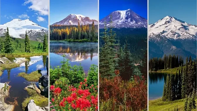
Washington is the epicenter of mountaineering in the lower 48 US states with more technical and glacier ascents than anywhere else outside of Alaska.
Washington also has 3 mountain-centric National Parks: Mount Rainier National Park, Olympic National Park, and North Cascades National Park. All 3 lie within a couple hours drive of the Seattle metro area. Over 4 million acres of mountainous wilderness areas protect vast trail networks leading to a lifetime of peaks to climb.
Here are the top 5 highest mountains in Washington for your reference.
1. Mount Rainier

Mount Rainier is a large active stratovolcano in the Cascade Range of the Pacific Northwest in the United States. The mountain is located in Mount Rainier National Park about 59 miles (95 km) south-southeast of Seattle. With a summit elevation of 14,417 ft (4,394 m), it is the highest mountain in the U.S. state of Washington and the Cascade Range, the most topographically prominent mountain in the contiguous United States, and the tallest in the Cascade Volcanic Arc.
Mount Rainier is considered one of the most dangerous volcanoes in the world, and it is on the Decade Volcano list. The large amount of glacial ice means that Mount Rainier could produce massive lahars that could threaten the entire Puyallup River valley.
The broad top of Mount Rainier contains three named summits. The highest is called the Columbia Crest. The second highest summit is Point Success, 14,158 ft (4,315 m), at the southern edge of the summit plateau, atop the ridge known as Success Cleaver. It has a topographic prominence of about 138 ft (42 m), so it is not considered a separate peak. The lowest of the three summits is Liberty Cap, 14,112 ft (4,301 m), at the northwestern edge, which overlooks Liberty Ridge. Liberty Cap has a prominence of 492 ft (150 m). A prominence cutoff of 400 ft (122 m) is commonly used in Washington state.
High on the eastern flank of Mount Rainier is a peak known as Little Tahoma Peak, 11,138 ft (3,395 m). It has a prominence of 858 ft (262 m), and it is almost never climbed in direct conjunction with Columbia Crest, so it is usually considered a separate peak.
Watch more: Mount Rainier | Washington's Highest Peak
2. Mount Adams
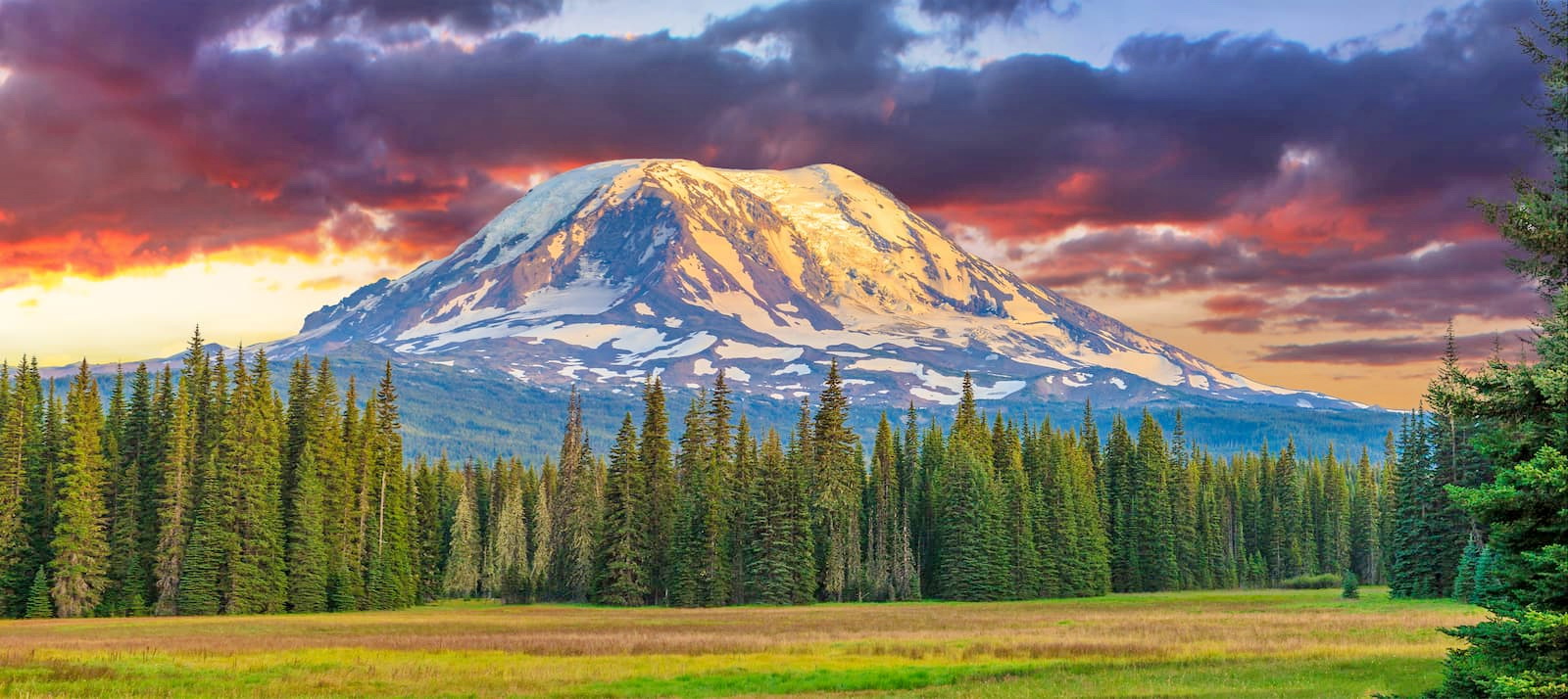
Mount Adams is a potentially active stratovolcano in the Cascade Range. Although Adams has not erupted in more than 1,000 years, it is not considered extinct. It is the second-highest mountain in Washington, after Mount Rainier.
Adams is a member of the Cascade Volcanic Arc, and is one of the arc's largest volcanoes, located in a remote wilderness approximately 34 miles (55 km) east of Mount St. Helens. The Mount Adams Wilderness consists of the upper and western part of the volcano's cone. The eastern side of the mountain is designated as part of the territory of the Yakama Nation.
Adams' asymmetrical and broad body rises 1.5 miles (2.4 km) above the Cascade crest. Its nearly flat summit was formed as a result of cone-building eruptions from separated vents. The Pacific Crest Trail traverses the western flank of the mountain.
3. Mount Baker

Mount Baker is a 10,781 ft (3,286 m) active glacier-covered andesitic stratovolcano in the Cascade Volcanic Arc and the North Cascades of Washington in the United States. Mount Baker has the second-most thermally active crater in the Cascade Range after Mount St. Helens. About 30 miles (48 km) due east of the city of Bellingham, Whatcom County, Mount Baker is the youngest volcano in the Mount Baker volcanic field. The volcanism has persisted here for some 1.5 million years, the current volcanic cone is likely no more than 140,000 years old, and possibly no older than 80–90,000 years.
After Mount Rainier, Mount Baker has the heaviest glacier cover of the Cascade Range volcanoes; the volume of snow and ice on Mount Baker, 0.43 cu mi (1.79 km3) is greater than that of all the other Cascades volcanoes (except Rainier) combined. It is also one of the snowiest places in the world; in 1999, Mount Baker Ski Area, located 9 mi (14.5 km) to the northeast, set the world record for recorded snowfall in a single season—1,140 in (29 m; 95 ft).
Mount Baker is the third-highest mountain in Washington and the fifth-highest in the Cascade Range, if Little Tahoma Peak, a sub peak of Mount Rainier, and Shastina, a sub peak of Mount Shasta, are not counted. Located in the Mount Baker Wilderness, it is visible from much of Greater Victoria, Nanaimo, and Greater Vancouver in British Columbia, and to the south, from Seattle in Washington.
A considerable amount of research has been done at Mount Baker over the past decade, and it is now among the most-studied of the Cascade volcanoes. Recent and ongoing projects include gravimetric and GPS-based geodetic monitoring, fumarole gas sampling, tephra distribution mapping, new interpretations of the Schriebers Meadow lava flow, and hazards analyses. Mapping of Carmelo and Sherman craters, and interpretations of the eruptive history, continue, as well. The Mount Baker Volcano Research Center maintains an online archive of abstracts of this work, and an extensive references list, as well as photos.
4. Glacier Peak

Glacier Peak is the most isolated of the five major stratovolcanoes of the Cascade Volcanic Arc in the U.S state of Washington. Located in the Glacier Peak Wilderness in Mount Baker–Snoqualmie National Forest, the volcano is visible from the west in Seattle, and from the north in the higher areas of eastern suburbs of Vancouver such as Coquitlam, New Westminster and Port Coquitlam.
The volcano is the fourth tallest peak in Washington state, and not as much is known about it compared to other volcanoes in the area. Local Native Americans have recognized Glacier Peak and other Washington volcanoes in their histories and stories. When American explorers reached the region, they learned basic information about surrounding landforms, but did not initially understand that Glacier Peak was a volcano.
Positioned in Snohomish County, the volcano is only 70 miles (110 km) northeast of downtown Seattle. From locations in northern Seattle and northward, Glacier Peak is closer than the more famous Mount Rainier (Tahoma), but as Glacier Peak is set farther into the Cascades and almost 4,000 feet (1,200 m) shorter, it is much less noticeable than Mount Rainier.
Glacier Peak is one of the most active of Washington's volcanoes. The volcano formed during the Pleistocene epoch, about one million years ago, and since the most recent ice age, it has produced some of the largest and most explosive eruptions in the state. When continental ice sheets retreated from the region, Glacier Peak began to erupt regularly, erupting explosively five times in the past 3,000 years. It has erupted repeatedly during at least six periods; two of these eruptions have been among the largest in Washington.
5. Bonanza Peak

Bonanza Peak is a tall peak in the North Cascades in the U.S. state of Washington and the Glacier Peak Wilderness of the Wenatchee National Forest. At 9,516 feet (2,900 m) in elevation, it is the highest point in Chelan County, and the highest non-volcanic peak in Washington and the Cascade Range as a whole. Bonanza Peak's prominence is 3,711 feet (1,131 m), making it the 26th most prominent peak in Washington. The nearest higher peak is Glacier Peak, 14.4 miles (23.2 km) to the southwest.
Bonanza Peak is flanked with three large glaciers: Company Glacier to the north, Mary Green Glacier to the east, and Isella Glacier to the south.
The history of the formation of the Cascade Mountains dates back millions of years ago to the late Eocene Epoch. With the North American Plate overriding the Pacific Plate, episodes of volcanic igneous activity persisted. Glacier Peak, a stratovolcano that is 14.4 mi (23.2 km) southwest of Bonanza Peak, began forming in the mid-Pleistocene. In addition, small fragments of the oceanic and continental lithosphere called terranes created the North Cascades about 50 million years ago.
During the Pleistocene period dating back over two million years ago, glaciation advancing and retreating repeatedly scoured the landscape leaving deposits of rock debris. The "U"-shaped cross section of the river valleys are a result of recent glaciation. Uplift and faulting in combination with glaciation have been the dominant processes which have created the tall peaks and deep valleys of the North Cascades area.
Thanks for reading this article!