
Nestled amidst the rugged landscapes of the American West, Utah is not only a region rich in natural scenery but is also often referred to as the "Mars of Earth." With a range of towering mountains that seem to reach for the sky, Utah has drawn nature enthusiasts and adventurers from all around the world. In this article, we embark on a journey to explore the highest peaks in Utah, where the unique and pristine natural beauty creates an exceptional destination for those passionate about exploring the wonders of nature. Join us as we delve into the world of Utah's Highest Mountains, where the marvels of Earth's untouched beauty still thrive.
Here are the top 5 highest mountains in Utah:
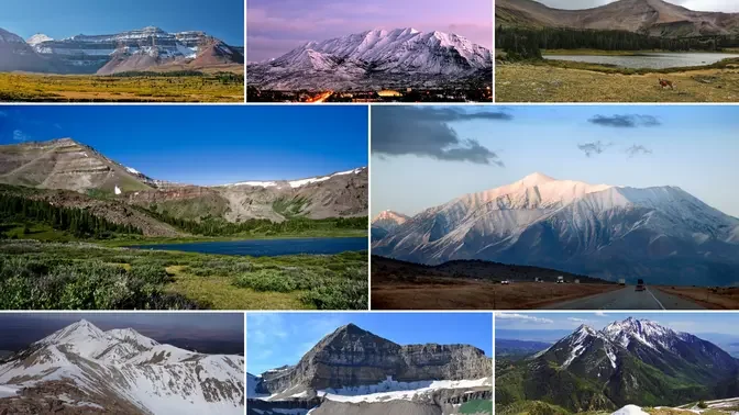
1. Kings Peak (4,123m)

Kings Peak is the highest mountain in the state of Utah, standing at an elevation of 4,123 meters. This mountain is situated within the Uinta Range, a unique east-west mountain range in North America. Kings Peak takes its name from Clarence King, an American geographer and explorer.
Kings Peak boasts a diverse landscape, ranging from pine forests, rivers, lakes, to rocky cliffs, snow, and glaciers. It is also home to many characteristic wildlife species of the region, such as black bears, mule deer, squirrels, eagles, wildflowers, and thistles.
What sets Kings Peak apart is its position as one of the highest points along the Great Basin Divide, a route that traverses the high plateaus and deserts of the Western United States. There are three popular routes to summit Kings Peak, one from the east, one from the north, and one from the south. The eastern route is the most challenging, involving steep and slippery rock climbs. The northern route is the easiest but also quite long and tiring. The southern route falls in between, offering beautiful and ever-changing scenery.

Kings Peak is considered one of the most challenging mountains to climb without requiring professional mountaineering skills or ice climbing. Even the easiest route involves a round-trip hike of 47 kilometers. Therefore, climbers need to prepare meticulously before embarking on their journey, carrying food, water, warm clothing, sturdy footwear, and safety equipment.
Climbers also need to be mindful of the weather and mountain conditions. Summer is the best time to climb Kings Peak due to less snow and ice. However, summer can also bring thunderstorms and severe weather. Autumn offers the most vibrant landscapes with colorful foliage. Winter is the most harsh and treacherous time, as it features heavy snow and ice, cold winds, and increased hazards.
2. Gilbert Peak (4,097m)

Gilbert Peak is the second-highest mountain in the Uinta Range, following Kings Peak. This mountain has an elevation of 4,097 meters and is situated within the Ashley National Forest. Gilbert Peak is named in honor of Gilbert Hovey Grosvenor, an American publisher and nature conservationist. He was the first editor-in-chief of National Geographic magazine and was one of the founders of the National Geographic Society in the United States.
Gilbert Peak is home to two small glaciers, the Conrad Glacier to the northeast and the Meade Glacier to the southeast of the summit. Gilbert Peak also features a variety of plant and animal species characteristic of the region, including pine trees, mountain goats, wildflowers, black bears, mule deer, and gray wolves.

What makes Gilbert Peak unique is its location within the Uinta Range, an area with many unexplored and less-visited mountains compared to the more famous peaks in Utah. This offers opportunities for exploration and a chance to connect with nature without the crowds. Like other mountains in the Uinta region, Gilbert Peak provides stunning panoramic views of the surrounding landscape, including the Uinta Range itself and the lakes in the area.
To summit Gilbert Peak, thorough preparation is essential, including equipment, timing, weather awareness, and physical fitness. You'll also need a hiking permit from the preserve management. Some common routes to the summit include starting from Warm Lake, Dollar Lake, or Henry's Fork. Depending on the route, the hike can take anywhere from 6 to 10 hours for the round trip. Camping options are available at designated areas along the way.
3. Mount Peale (3,877m)

Mount Peale is the highest peak in the La Sal Mountains of San Juan County, southeastern Utah, United States. It stands at an elevation of 3,877 meters and is also the highest point in Utah outside of the Uinta Range. Mount Peale is located approximately 32 kilometers southeast of Moab. The mountain is named after Albert Peale, a mineralogist on the 1875 Hayden Survey.
Mount Peale offers a diverse and stunning landscape and terrain. It rises dramatically from valley floors and desert terrain, creating a striking contrast. Those who have visited Canyonlands National Park or Arches National Park have likely admired these snow-covered peaks, which seem out of place in their surroundings. Mount Peale can be seen from the valley floor, albeit partially obscured by its neighboring peak, Mount Tukuhnikivatz.

Mount Peale is part of the Mount Peale Natural Research Area, which protects rare plant and animal species. Additionally, Mount Peale features a beautiful white snow couloir known as the South Face Couloir. This presents an enticing challenge for snow mountaineers. The couloir has an approximate slope of 40 degrees and is about 500 meters long. It is typically climbed in late spring or early summer when there is still snow.
At the summit of Mount Peale, you have the opportunity to enjoy panoramic views extending beyond the La Sal Range, reaching as far as the Colorado Mountains and Canyonlands National Park. This expansive vista creates an exciting and unique experience for travelers.
To climb Mount Peale, you should have experience with high-altitude mountaineering, proper gear, and preparedness for sudden weather changes. The ideal time to climb is from late May to mid-June when snow still covers the couloir. The average summer temperature at elevations over 3,000 meters is between 15 to 25 degrees Celsius. The La Sal Range provides a cool retreat from the scorching desert heat during the summer months.
4. Mount Nebo (3,636m)

Mount Nebo is the highest peak in the Wasatch Range in Utah, USA, standing at an elevation of 3,636 meters above sea level. It is located within the Mount Nebo Wilderness, which is part of the Uinta-Wasatch-Cache National Forest. The mountain is named after the biblical Mount Nebo, where it is believed Moses passed away.
Mount Nebo provides exceptional panoramic views of the surrounding landscapes. Visitors can take in the vistas of the Wasatch Range, Great Salt Lake, Uinta Mountains, and even the Ruby and La Sal Mountains in Utah. This expansive view offers an exciting experience for nature and mountain enthusiasts. Additionally, Mount Nebo is famous for its unique rock formations and caves. In the past, these caves were used for mineral mining and have now become an intriguing destination for explorers.

Fall is a particularly special time to visit Mount Nebo when the forested slopes transform with vibrant foliage, creating a picturesque and unique landscape that should not be missed.
In addition to hiking and climbing, the Mount Nebo area also attracts visitors with various outdoor activities such as mountain biking, camping, and long-distance hiking, providing excellent opportunities to immerse in the natural beauty of the Wasatch Range.
5. Mount Timpanogos (3,520m)

Mount Timpanogos is the second-highest peak in the Wasatch Range in Utah, USA. It is located in Utah County within the Uinta-Wasatch-Cache National Forest. Mount Timpanogos stands at an elevation of 3,582 meters (11,749 feet) above sea level, with an elevation gain of 1,606 meters (5,269 feet). The name "Timpanogos" is derived from the Timpanogos tribe, who inhabited the valleys surrounding the mountain from around 1400 AD. The name is said to mean "rock" (tumpi-) and "water mouth" or "mountain pass" (panogos).
The most unique feature of Mount Timpanogos is its diverse landscape, including valleys, streams, waterfalls, and pristine lakes. One of the most famous lakes is Emerald Lake, which features a perennially ice-covered formation resembling a whale's tail. The mountain also boasts an array of wildflowers blanketing its slopes in the summer, creating a stunning vista.

Additionally, Mount Timpanogos is home to the Timpanogos Cave System, the largest natural cave system in Utah, located on the northern side of the mountain. The caves feature a variety of beautiful formations, such as stalactites, stalagmites, cave bacon, and even a formation known as the "Great Heart." There's also a perennial snowfield known as the Timpanogos Glacier on the north-facing slope, which often retains snow year-round. This glacier is a relic from the ice age and may be one of the few remaining glaciers in Utah, although it's not considered a "true" glacier as it consists of dirty ice.
The Timpanogos Cave System is a complex and diverse underground network of passages and chambers. Visitors have the opportunity to explore parts of this cave system with the assistance of guides.
Fall is a particularly special time to visit Mount Timpanogos when the foliage begins to change color. The landscape transforms into a picturesque display of reds and golds, creating a dreamy scene for visitors.
See more: Utah's Otherworldly Landscapes